Build a set for your routes and fishing.

Baltic Depth Maps
Depth maps of Lithuanian and Latvian waters
Detailed depth maps for Lowrance, Simrad and B&G fish finders. Select the waters you need and see the full order price immediately.
Benefits
Everything you need for confident navigation
The memory card is prepared before shipping.
Convenient parcel-locker delivery across Lithuania.
We make custom depth maps for Humminbird and Garmin fish finders.
Compatibility
Lowrance, Simrad и B&G
Full support for Lowrance HDS Gen3, HDS Carbon, HDS Live, HDS Pro, Elite TI, Elite TI2 and Elite FS. Vector maps are available for HOOK, HOOK², HOOK Reveal and Eagle. Simrad GO, NSS, NSX, NSO and B&G Vulcan and Zeus are also supported.
New service
US Lowrance fish finder configuration
Geofencing removal and language-pack installation for compatible US Lowrance units. Geofencing and the European language pack are completed remotely using Request Codes. The Russian language pack is installed physically only — the unit must be shipped to us or brought in person.
Lowrance Geofencing Unlock & Language Pack — details
Remote25 €
Geofencing removal
Compatible models: HDS Carbon, HDS LIVE, HDS PRO
A dedicated Request Code for geofencing removal is required.
Remote25 €
European language pack
Compatible models: Elite Ti2, Elite FS, HDS Carbon, HDS LIVE, HDS PRO
A separate Request Code for the language pack is required.
Remote40 €
Geofencing + European language pack
Compatible models: HDS Carbon, HDS LIVE, HDS PRO
This service requires two different Request Codes: one for geofencing and one for the language pack.
Physical service only50 €
Russian language pack
Compatible models: Elite Ti2, Elite FS, HDS Carbon, HDS LIVE, HDS PRO
The Russian language pack is installed physically only: ship the unit to us or bring it in person.
Choose a service
After verifying the details, we will contact you about payment and completing the service.
Real product
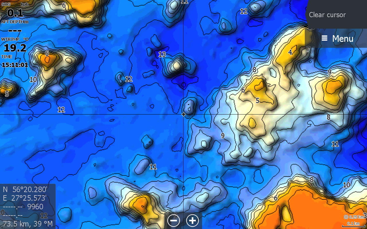
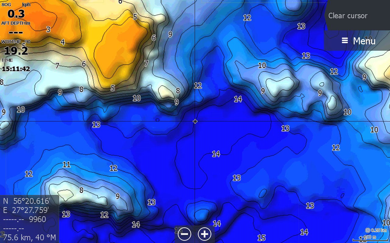
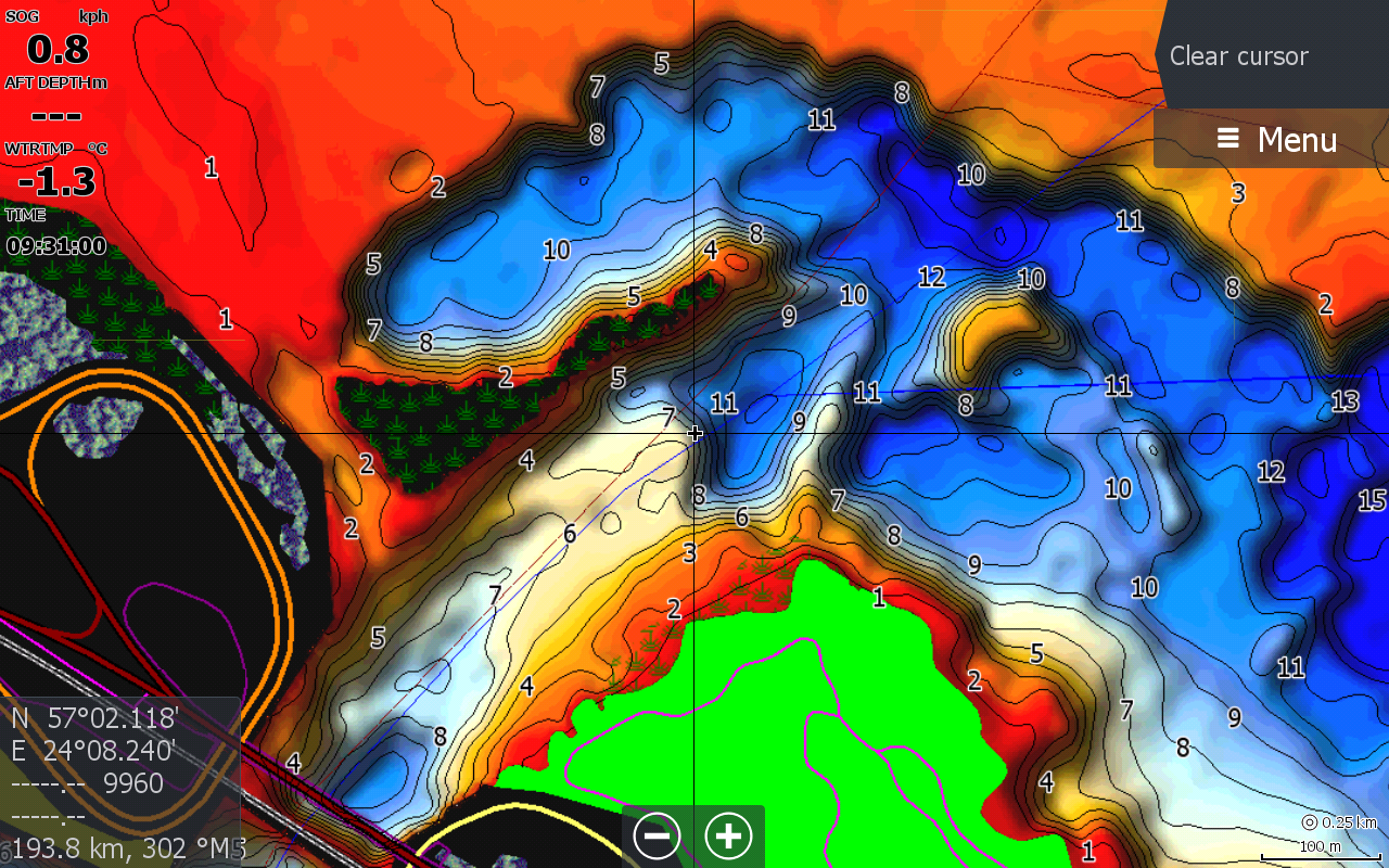
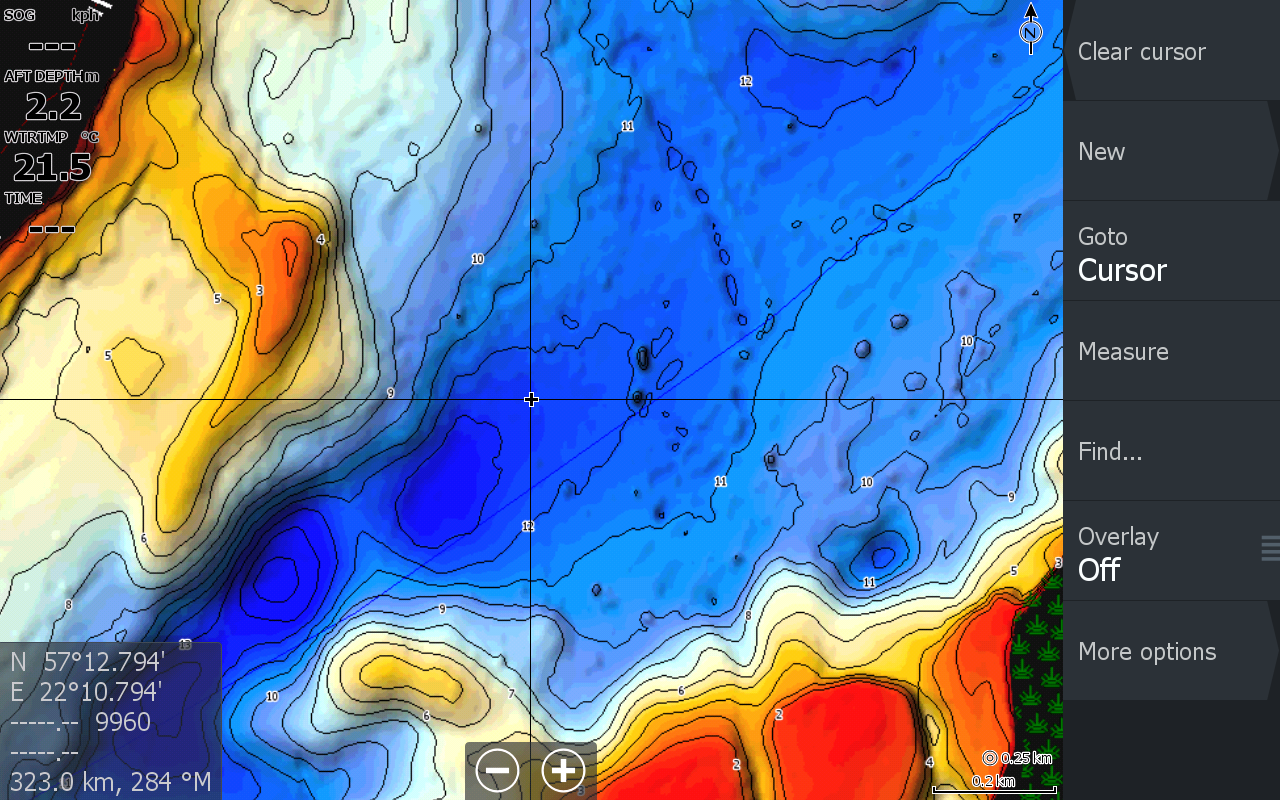
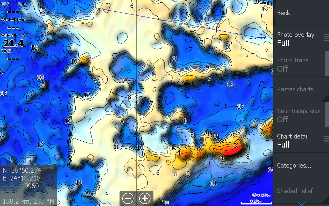
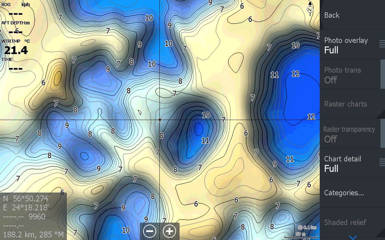
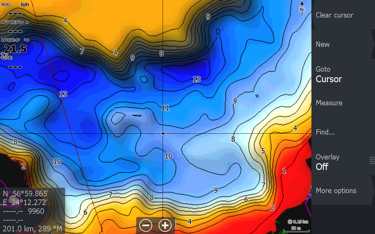
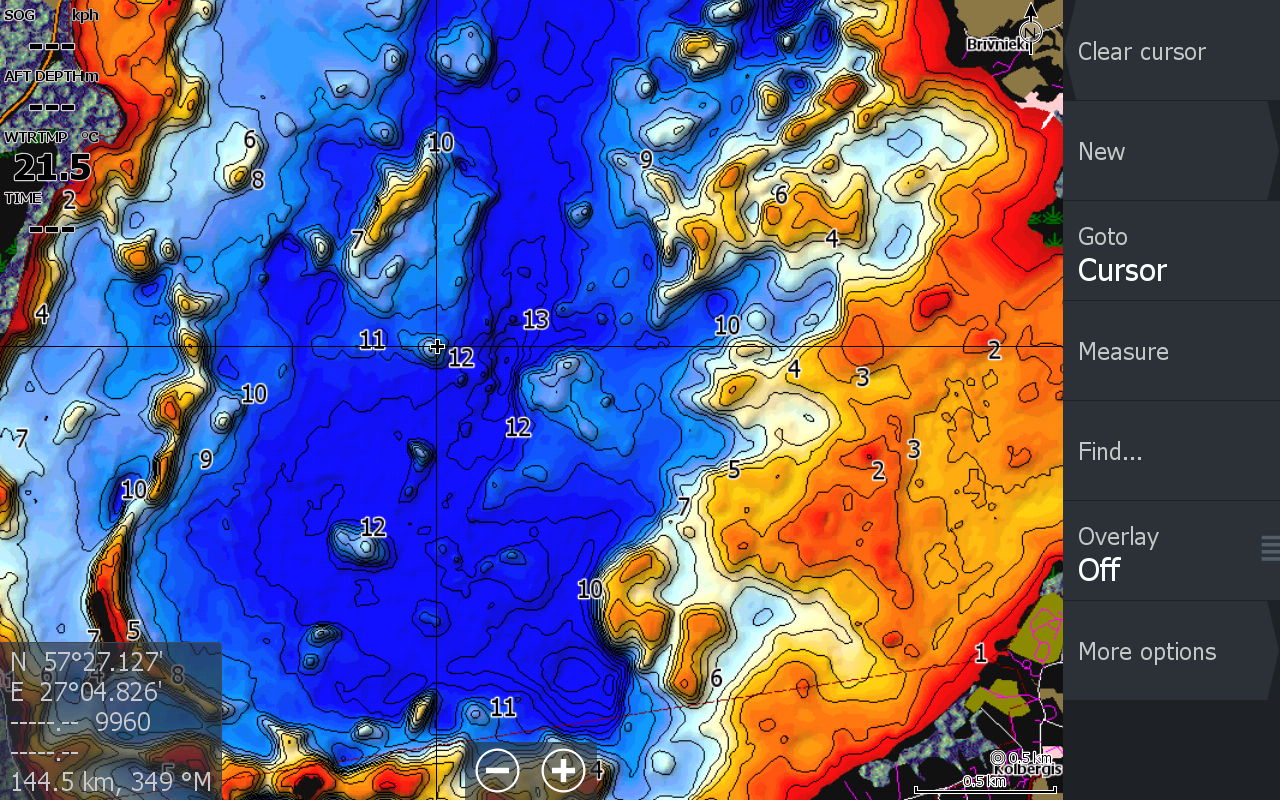
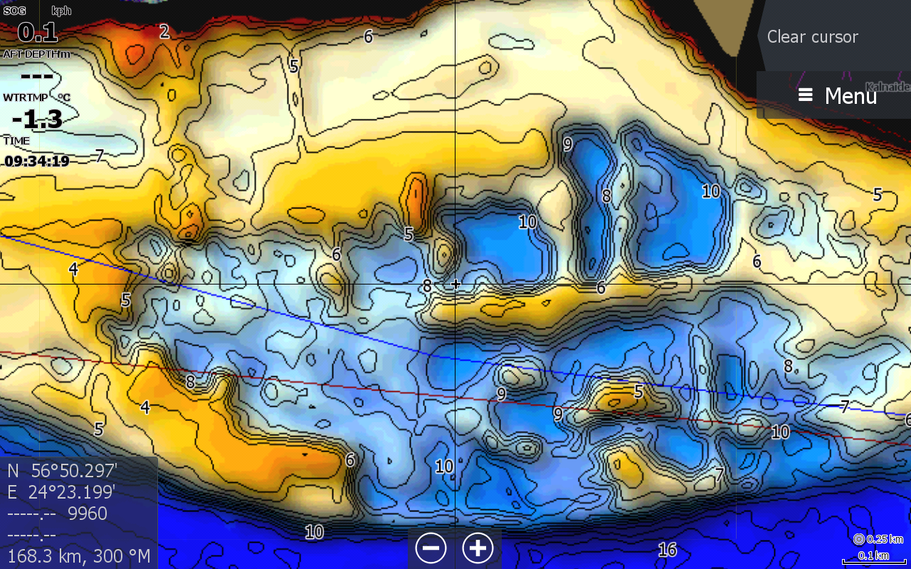
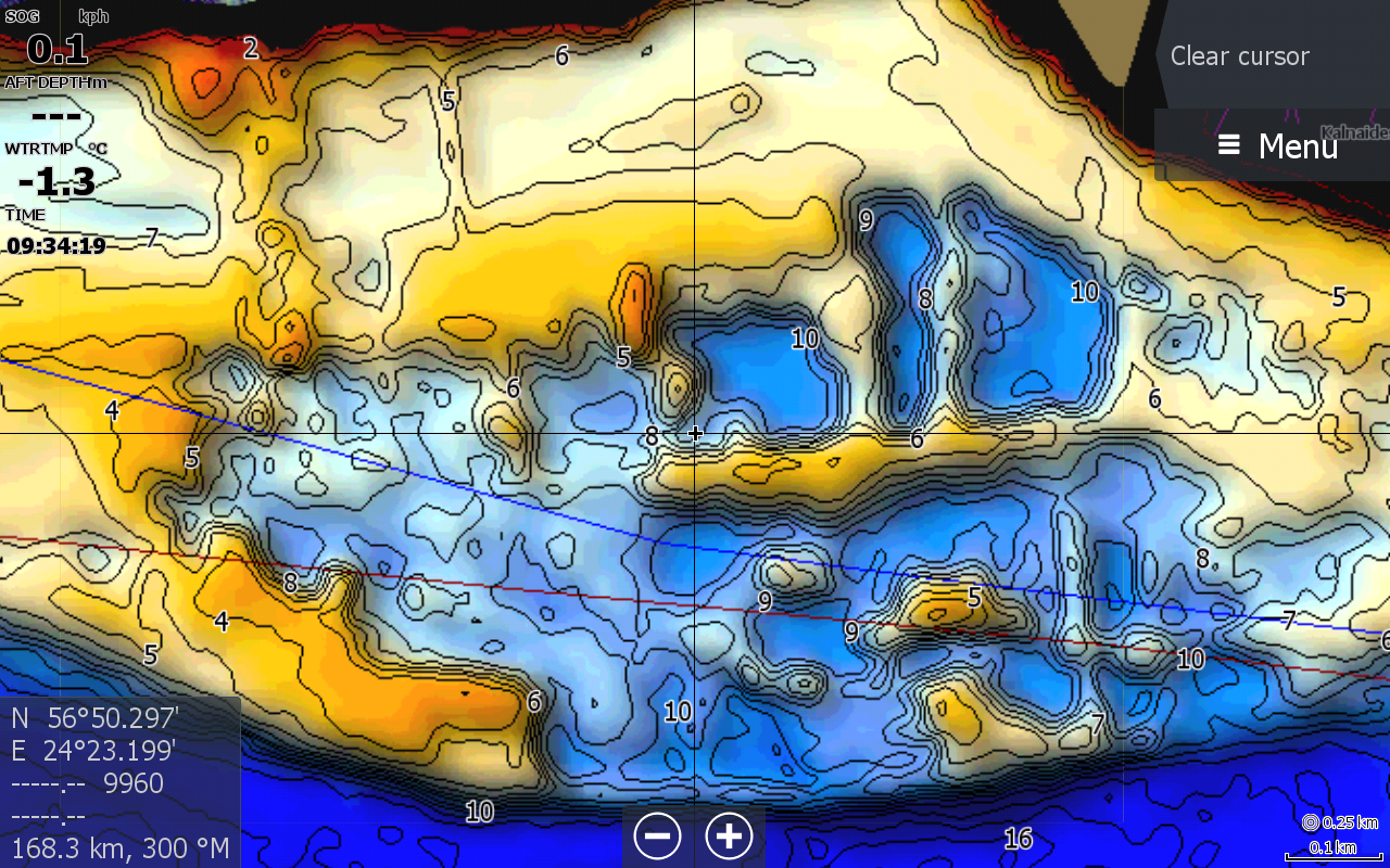
Map examples on a fish finder
Real Baltic Depth Maps examples: contours, depths, drop-offs, holes and underwater relief.
Instructions
How to enable the map
A short guide to enabling the raster depth map.
1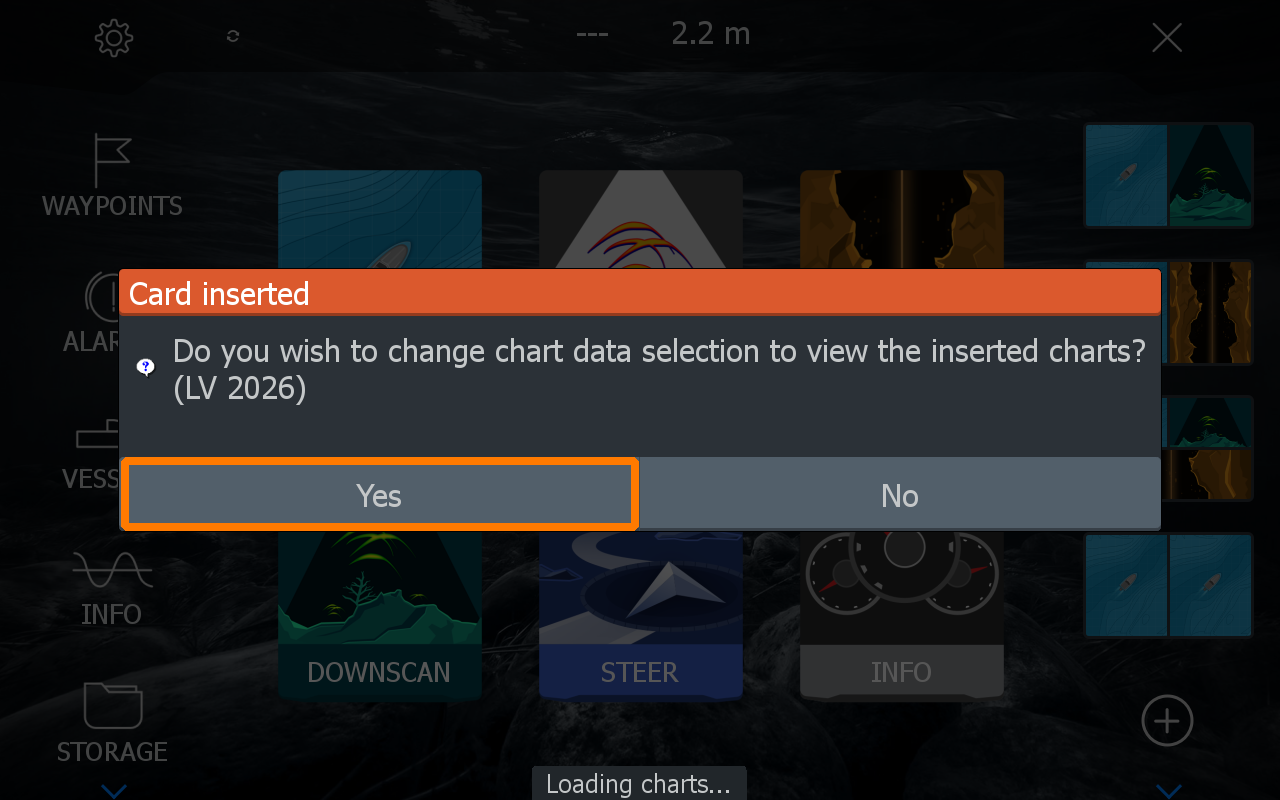
Confirm the chart selection — the vector charts will be enabled immediately.
2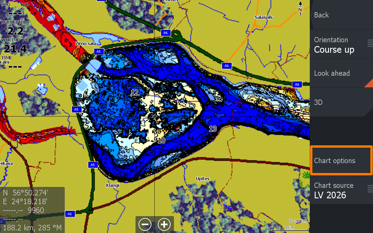
Select Chart Options.
3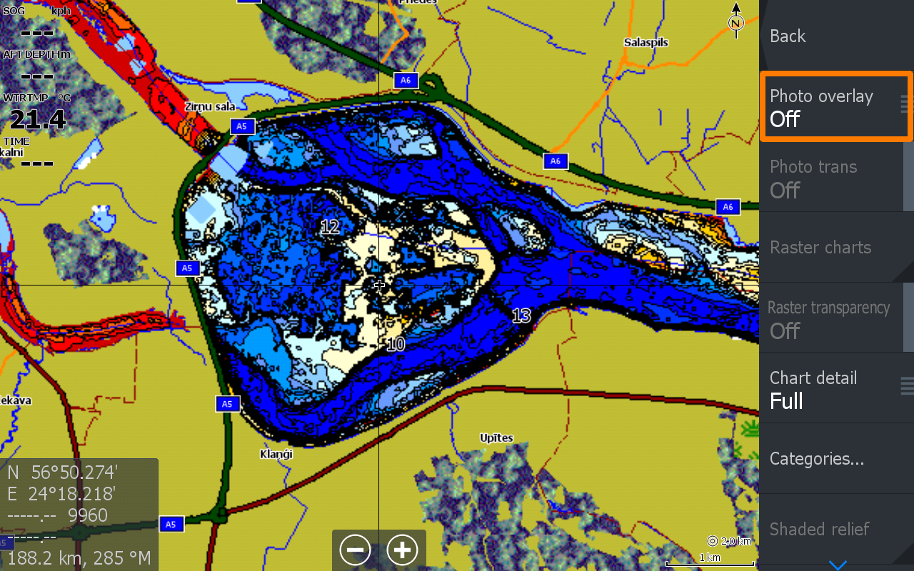
Select Photo overlay.
4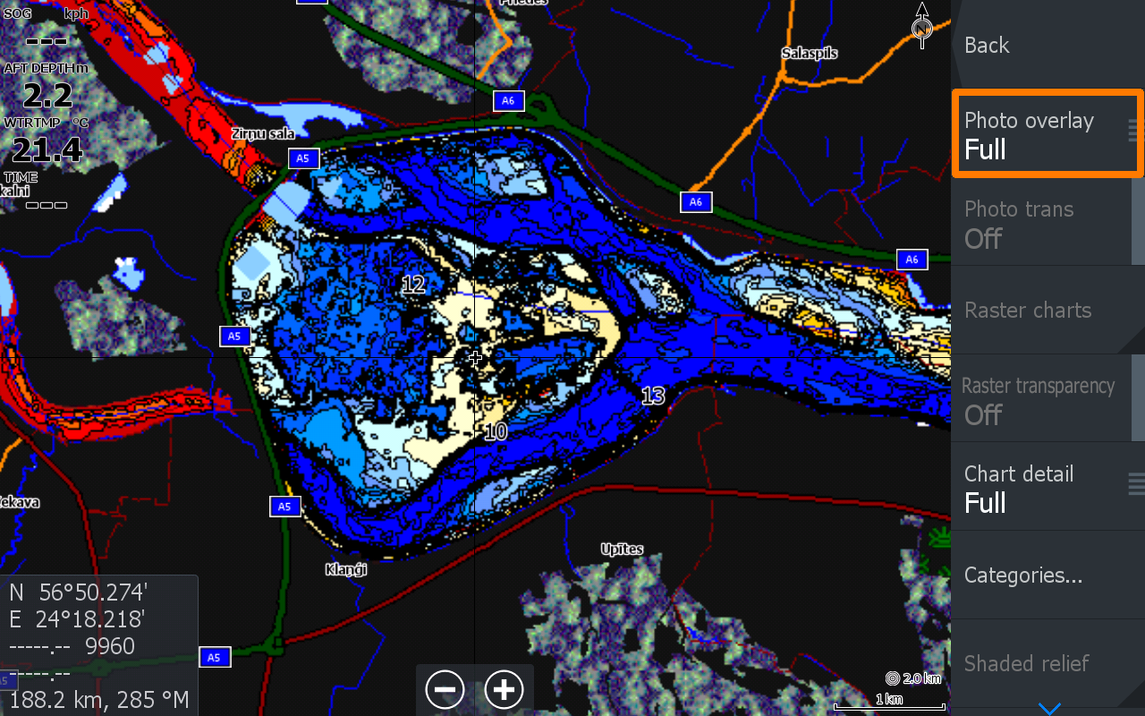
Set Photo overlay to FULL.
5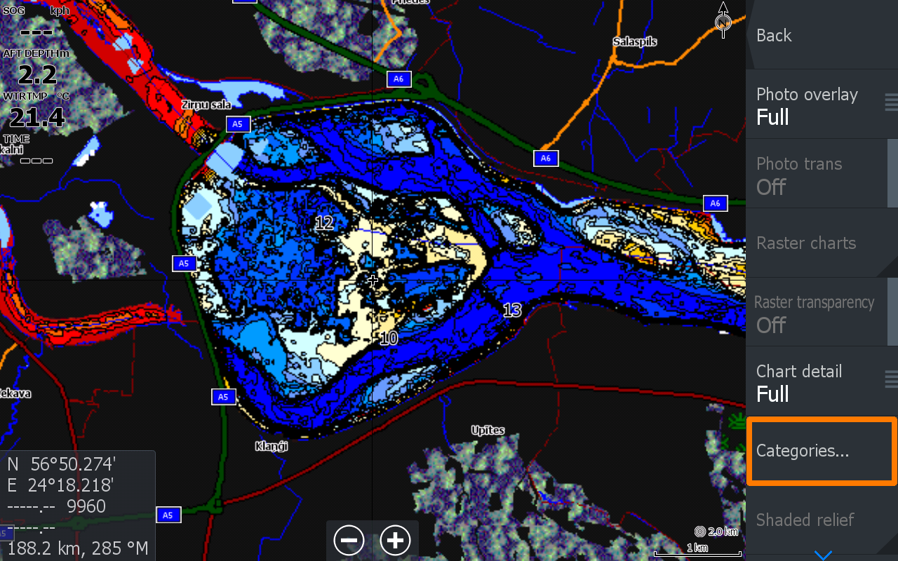
Select Categories.
6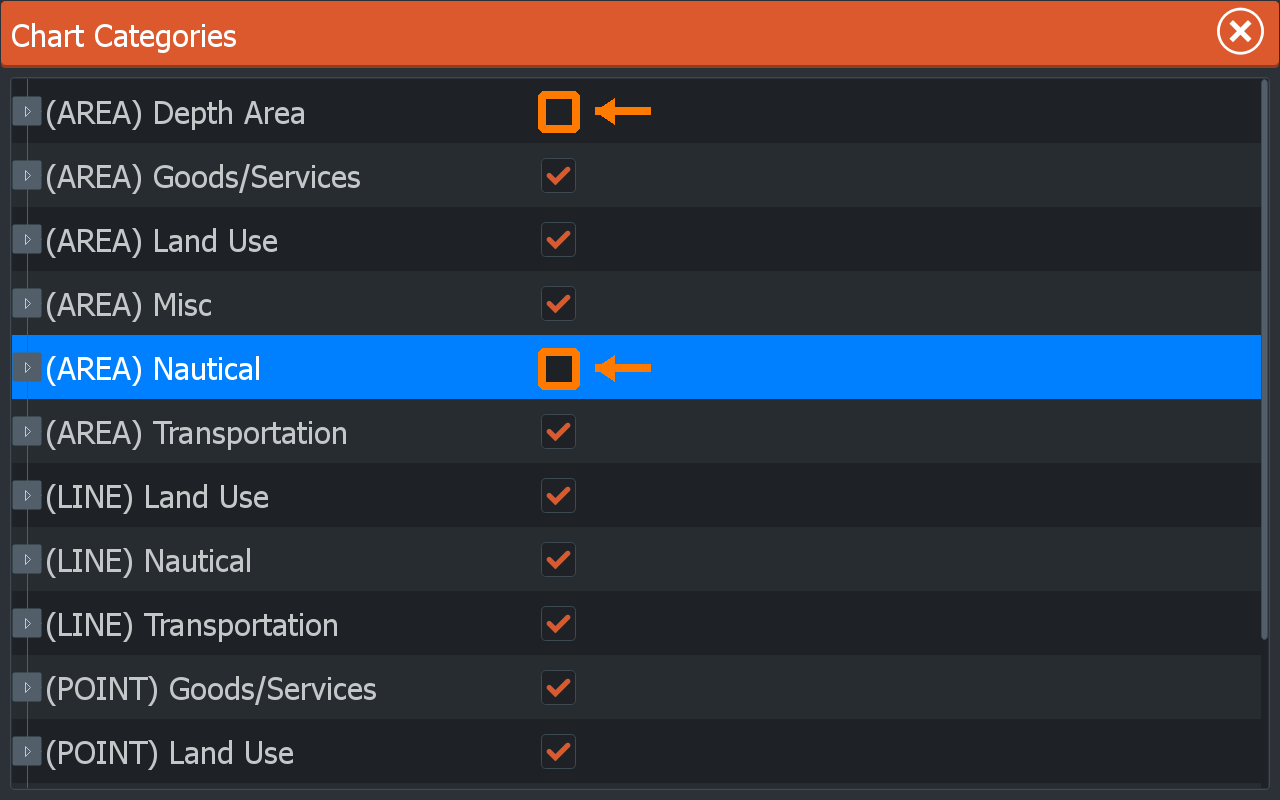
In Chart Categories, disable the first and fifth items (clear the checkboxes).
7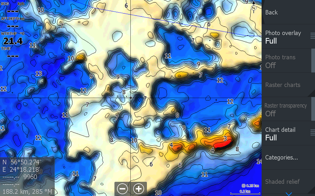
You will get a raster depth map with contour overlay.
Lithuania catalog
Build your map set
Best-value set — up to 40 waters for €140
Choose the waters yourself. When all 40 map slots are filled, the set price automatically becomes €140. microSD and delivery are included.
Aisetas5 €
Akmena5 €
Alaušai5 €
Alaušas5 €
Alnis5 €
Angirių tvenkinys5 €
Antalieptės marios5 €
Arinas5 €
Asalnai5 €
Asveja5 €
Avilys5 €
Balskų tvenkinys5 €
Baltieji Lakajai5 €
Baluošai5 €
Baluošas5 €
Bartuvos tvenkinys5 €
Bebrusai5 €
Bubių tvenkinys5 €
Čičiriai5 €
Didžulis5 €
Dirdų tvenkinys5 €
Drąseikiai5 €
Dringis5 €
Drūkšiai10 €
Dūkštas5 €
Dusia10 €
Dviragis5 €
Dysnai10 €
Dysnykštis5 €
Elektrėnai10 €
Erzvėtas5 €
Galstas5 €
Galuonai5 €
Galuonis5 €
Galvė5 €
Gėlių ežeras5 €
Gruodys5 €
Gudelių ežeras5 €
Ilgai5 €
Ilgis5 €
Juodeikių tvenkinys5 €
Juodieji Lakajai5 €
Kauno marios + Nemunas20 €
Kupiškio marios5 €
Labės ežeras5 €
Lūkstas5 €
Lūšiai5 €
Luodis10 €
Makys5 €
Margis5 €
Mastis5 €
Metelys5 €
Monis5 €
Nava5 €
Nevėža5 €
Nikajis5 €
Obelija5 €
Paežeriai5 €
Perkalys5 €
Peršokšnai5 €
Plateliai5 €
Plinkšių ežeras5 €
Rašia5 €
Rėkyva5 €
Rubikiai5 €
Šalotis5 €
Sartai10 €
Seirijis5 €
Sienis5 €
Siesartis5 €
Skaistis5 €
Smalvas5 €
Snaigynas5 €
Stirniai5 €
Tauragnas5 €
Ūkojas5 €
Ušiai5 €
Vencavas5 €
Vievis5 €
Vilkoksnis5 €
Virintai5 €
Žaduojys5 €
Žirnajai5 €
Zapsys5 €
Zarasas5 €
No water found.
Custom order
Need a map for Humminbird or Garmin?
We accept custom depth-map orders for Humminbird and Garmin fish finders. Tell us the device model and the water you need, and we will confirm availability.
How it works
From selection to delivery
1Select the waters and your fish finder model.
2We will check the order and send an invoice.
3After payment, we will prepare the microSD.
4We will ship the order via DPD Pickup.